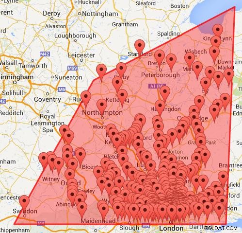
Chcete-li odstranit body v dotazu ohraničujícího rámečku, ale ne v rámci polygonu, musíte použít Point in Polygon algoritmu.
Nejjednodušší způsob, jak toho dosáhnout, je mít souřadnice v polích. Ty lze použít k nalezení maximálních a minimálních souřadnic pro dotaz a pro parametry funkce pointInPolygon().
function pointInPolygon(polySides,polyX,polyY,x,y) {
 var j = polySides-1 ;
  oddNodes = 0;
  for (i=0; i<polySides; i++) {
    if (polyY[i]<y && polyY[j]>=y  ||  polyY[j]<y && polyY[i]>=y) {
        if (polyX[i]+(y-polyY[i])/(polyY[j]-polyY[i])*(polyX[j]-polyX[i])<x)  {
            oddNodes=!oddNodes;
        }
    }
   j=i; }

  return oddNodes;
}
V kódu mapy pomocí jQuery getJSON()
var polySides = 4;//number of points in polygon
//horizontal Latitude coordinates of polygon
var polyLat = new Array();
polyLat[0] = 51.5;
polyLat[1] = 51.5;
polyLat[2] = 52.5;
polyLat[3] = 53;
polyLat[4] = 51.5;//First point repeated to close polygon
//vertical Longitude coordinates of polygon
var polyLng =  new Array();
polyLng[0] = 0.5;
polyLng[1] = -1.9;
polyLng[2] = -1;
polyLng[3] = 0.6;
polyLng[4] = 0.5;
//Coordinates for bounding box
var maxLat = Math.max.apply(null,polyLat);
var minLat = Math.min.apply(null,polyLat);
var maxLng = Math.max.apply(null,polyLng);
var minLng = Math.min.apply(null,polyLng);

//Using jQuery
var url = "yourFile .php";
 url +="?maxLat="+maxLat +"&minLat="+minLat +"&maxLng="+maxLng +"&minLng="+minLng;
 $.getJSON(url,function(data) {
    $.each(data.marker,function(i,dat){
        if (pointInPolygon(polySides,polyLat,polyLng,dat.lat,dat.lng)){
            var latlng = new google.maps.LatLng(dat.lat,dat.lng);
            addMarker(latlng,dat.name);
            bounds.extend(latlng);
        }
    });
    map.fitBounds(bounds);
});
Mapa získaná pomocí Bounding Box and Point in Polygon.

